3D Relief Maps

Explore the Art of Transforming
flat 2D or Vintage Maps into 3D Masterpieces

iceland historical 3d relief map

Welcome to our 3D Relief Maps section, where you can learn how to transform your 2D vintage maps into captivating 3D relief models using downloadable heightmaps and texture sets.

Explore the art of cartography and elevate your vintage maps with our step-by-step guides and resources.

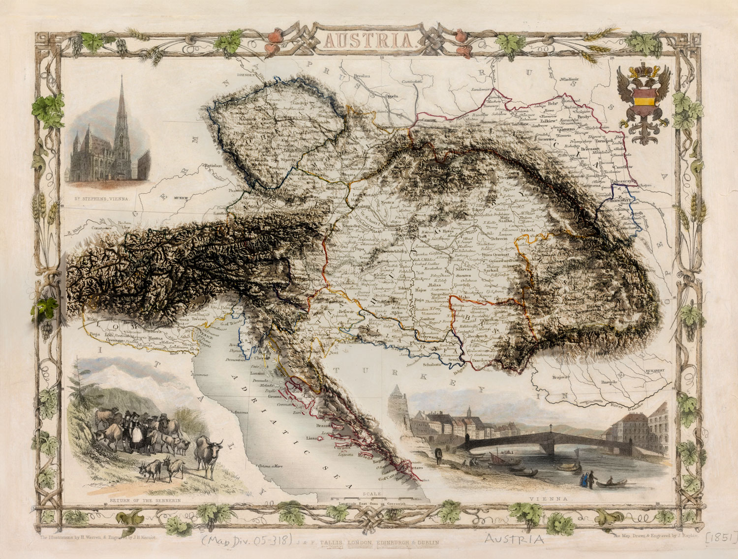
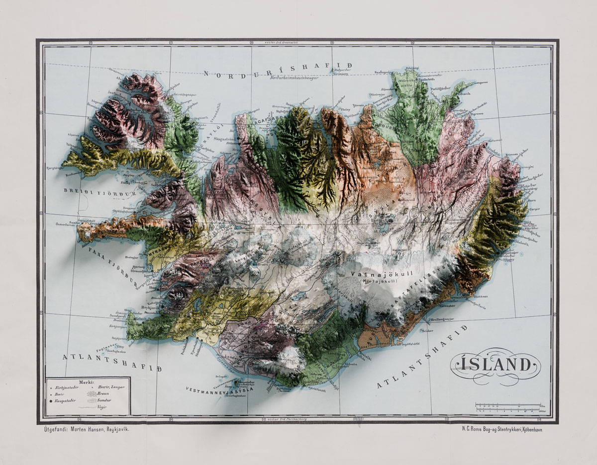
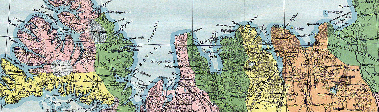
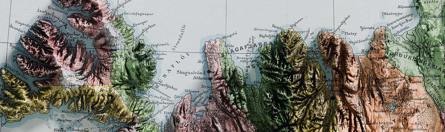
NOTE: This example features a hand-colored map of Iceland from Morten Hansen, the school principal, produced this map for Icelandic geography education, addressing the need for a suitable resource. It features colored counties and marked capitals, with design revisions by Þorvaldur Thoroddsen.

Beforeafter

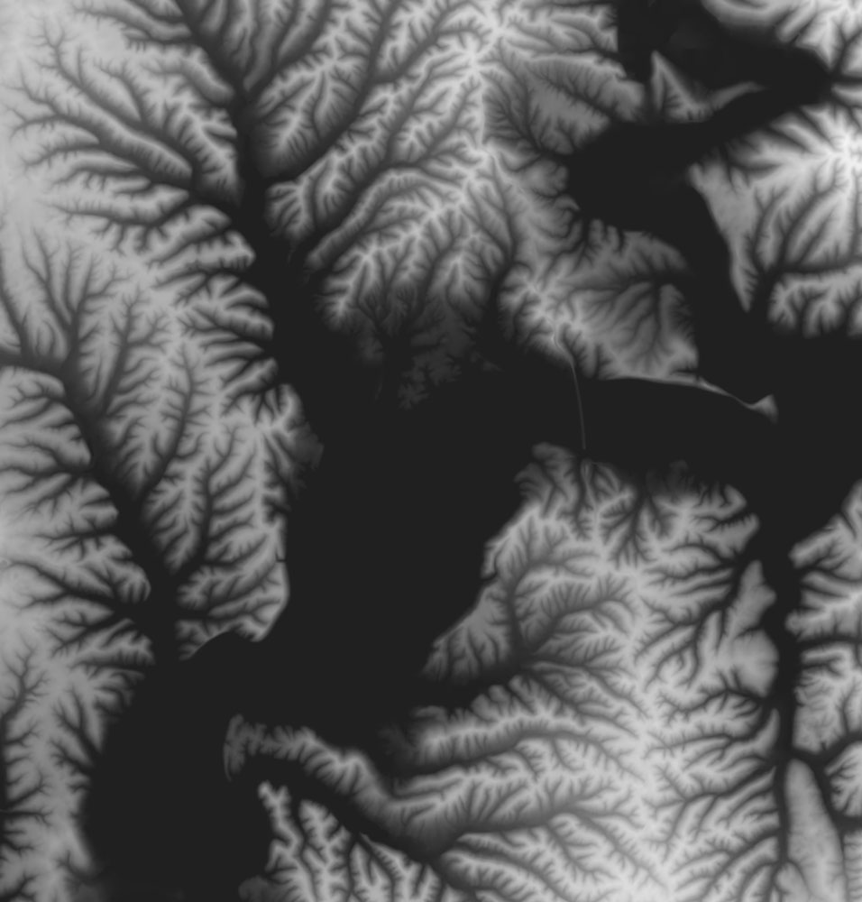
What are Heightmaps?
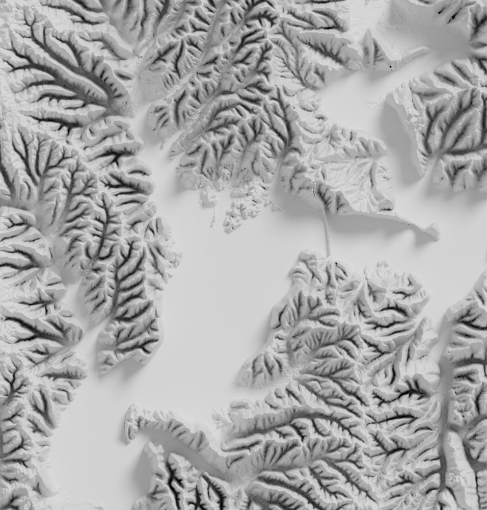
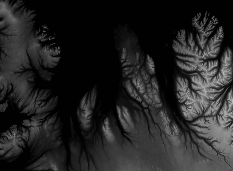
Heightmaps are grayscale images that represent elevation data of terrains. By leveraging these heightmaps along with texture sets, you can convert historical maps into immersive 3D relief models using software like Blender.

How to make a 3d relief map
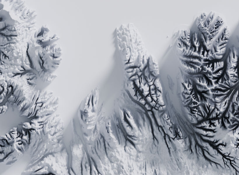
To begin, select the area of your vintage map using our Location Browser and download the high-resolution heightmap-texture set. Next, use a photo editing tool like GIMP to adjust and apply the heightmap to your vintage map. Then, in Blender, generate a displacement map from the heightmap and use your vintage map as a texture to recreate historical landscapes in stunning three-dimensional detail.

Heightmap3D Relief Map

How to create a relief map

Getting Started

  • Location Selection: Choose the area of interest from your vintage map in our Location Browser.
  • Download Resources: Obtain the hi-res heightmap-texture set corresponding to your selected area.
  • Map Adjustment: Use GIMP or similar tools to align and integrate the heightmap with your vintage map.
  • Blender Workflow: Import the adjusted heightmap into Blender, generate a displacement map, and apply your vintage map as a texture to create your customized historical 3D relief map.

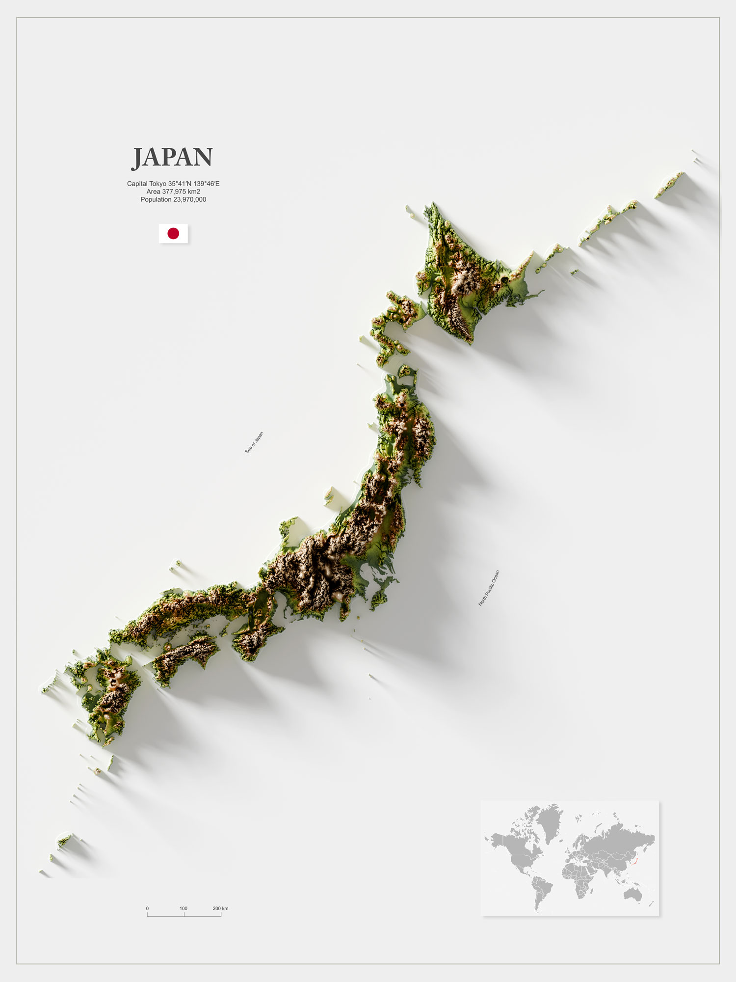
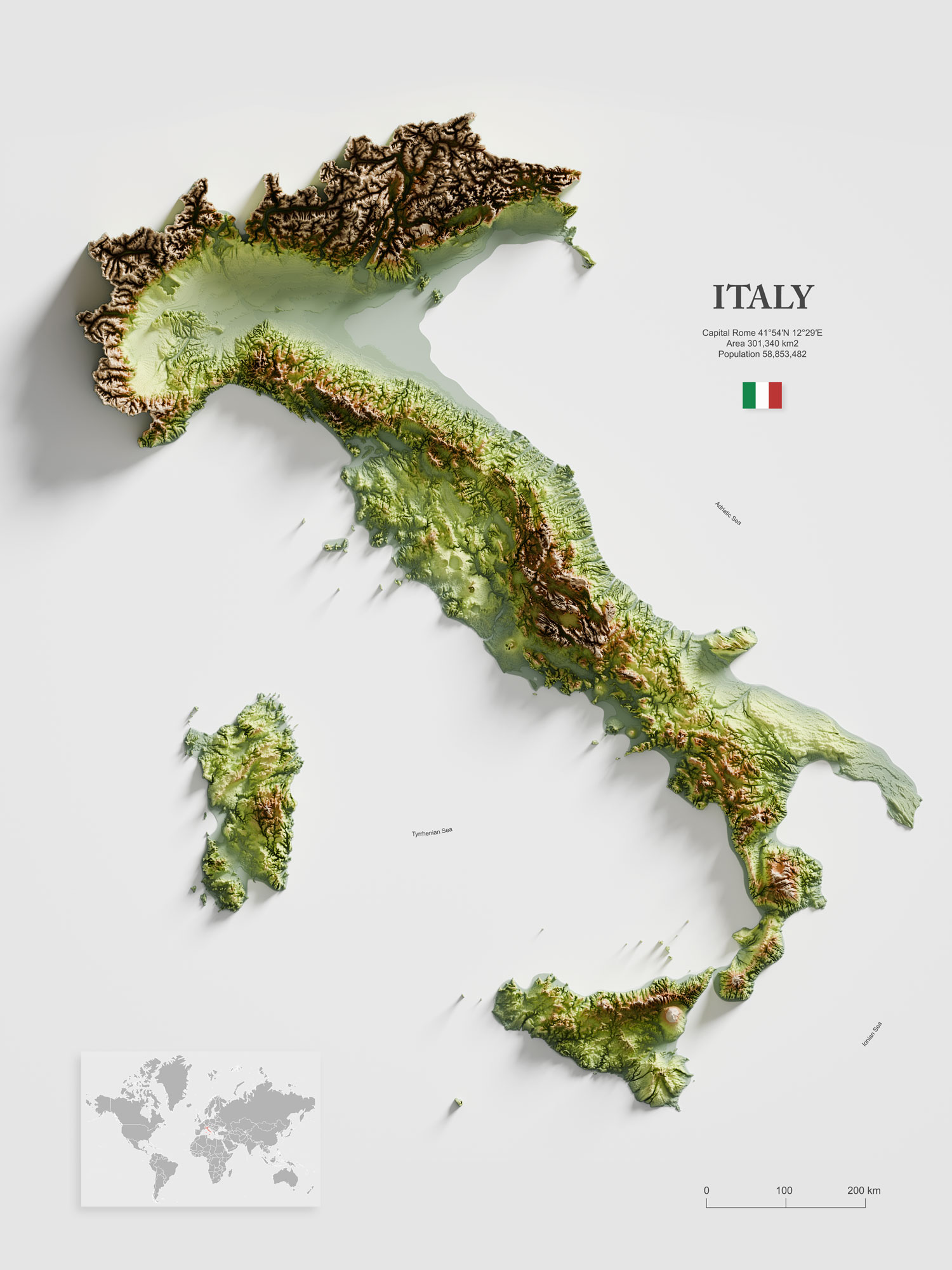
Enhance your vintage map and breathe new life into it by utilizing our heightmaps and 3D modeling techniques.

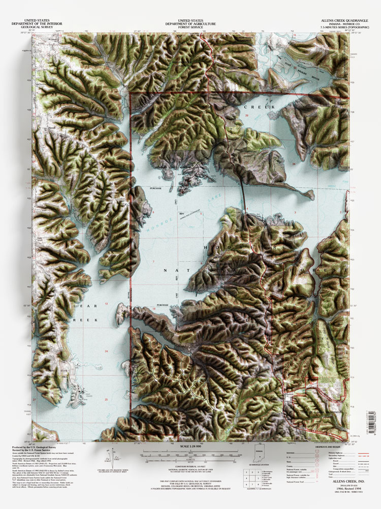
This vintage example map from 1966/1994, along with thousands of others, can be found on the USGS Historical Topographic Map Explorer.

Heightmap3D Relief

Relief Map Examples

japan 3d relief map
italy 3d relief map
u.s.a. 3d relief map
austria 3d relief map
france 3d relief map
australia 3d relief map

What is a 3D/Terrain Map?

  • Definition: A 3D or terrain map displays geographic information in three dimensions, focusing on the natural landform features such as mountains, valleys, and hills.
  • Features: Detailed depictions of topographic features, often with precise elevation information and geological details.
  • Uses: Geosciences, environmental research, urban planning, outdoor activities, and game development.
  • Example: Digital Elevation Models (DEM), Google Earth.

What is a Relief Map?

  • Definition: A relief map is a type of map that represents the topographic features of an area through shading and color coding to visualize elevation differences.
  • Features: Two-dimensional representation with optical effects that make the terrain appear three-dimensional.
  • Uses: Education, hiking, simple geographic orientation.
  • Example: Physical maps in school atlases.

How do these map types differ?

  • Level of Detail:

    • 3D/Terrain Map: Highly detailed, showing natural landforms and elevation information in three dimensions.
    • Relief Map: Simplified but visually intuitive representation of elevation differences through shading and colors.
  • Interactivity:

    • 3D/Terrain Map: Highly interactive, often with navigation and zoom features.
    • Relief Map: Usually static and non-interactive.
  • Purpose:

    • 3D/Terrain Map: Versatile use, especially for professional applications in science, planning, and outdoor activities.
    • Relief Map: Primarily for educational purposes and simple topographic orientation.

Which map is right for me?

  • 3D/Terrain Map: Choose this if you need detailed information about natural topography and want interactive features.
  • Relief Map: Choose this if you want a simple and visually understandable representation of elevation differences that is easy to interpret.

Summary

  • 3D/Terrain Maps provide detailed, three-dimensional representations of natural landforms and are ideal for scientific, planning, and outdoor applications.
  • Relief Maps are two-dimensional, visually intuitive representations of elevation differences, making them particularly useful for educational purposes and simple geographic orientation.