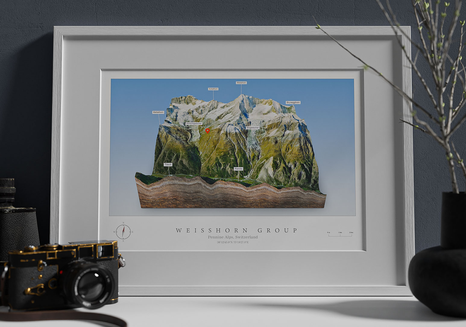
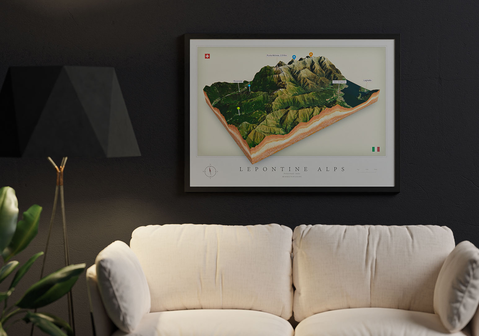
Print a Piece of Switzerland as 3D Map
You can export your 3D maps as PNG files with transparent background in a size of up to 4000 x 4000 px. You can easily integrate this PNG into your layout and create print files from it. For example for canvas prints, poster, brochures or flyers.
3D Print Switzerland Terrain

Embed Switzerland 3D Map on your Website
You can easily embed your 3D maps on your website. You can create labels and pins. Use different textures for the map borders and background sky.
Your visitor can explore the map by rotating and zooming. The interactive 3D map is not just a image of a piece of India, it is an eye-catcher and the visitor will enjoy your website!
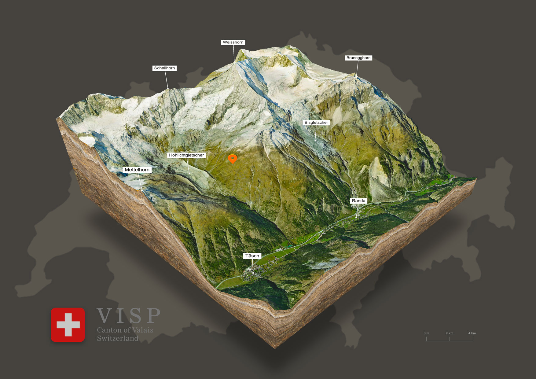
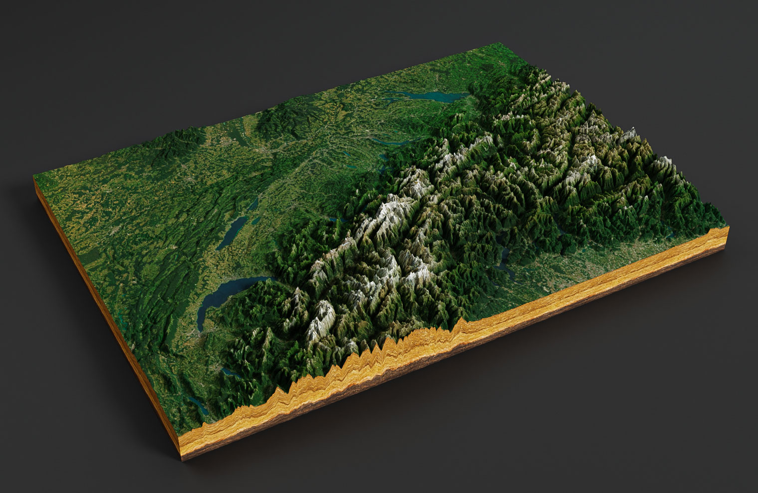
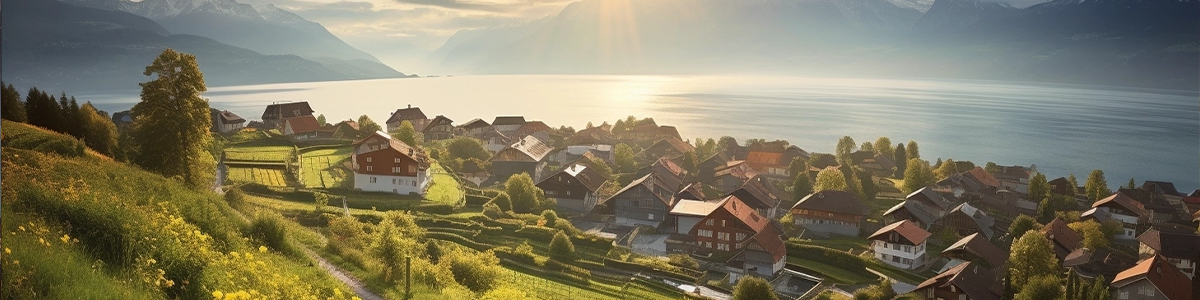
This 3D map shows the Weisshorn Group with the Weisshorn, a major peak of Switzerland and the Alps. It is part of the Pennine Alps and is located between in the canton of Valais.
Download Switzerland 3D Map as 3D file
Export the 3D map as a 3d file and use it in other 3D software. GLB or glTF can be selected as the export format.
In the example you see a 3D map of Switzerland rendered with Blender. It was imported with our free Blender add-on.
Facts about Switzerland

Switzerland (French: Suisse , in German: Schweiz), officially the Swiss Confederation, is a mountainous country in Central Europe with many lakes and valleys.
Switzerland is a landlocked country located in Central Europe known for its natural beauty, alpine landscapes, and banking and financial industries. Here are some key facts about Switzerland:
Geography: Switzerland is a small country with an area of approximately 41,290 square kilometers. It is bordered by Germany to the north, France to the west, Italy to the south, and Austria and Liechtenstein to the east. The country is known for its mountains, lakes, and forests, and is home to many famous landmarks such as the Matterhorn and Lake Geneva.
Demographics: Switzerland has a population of approximately 8.6 million people, with German, French, and Italian being the official languages. The country is known for its cultural diversity, with significant populations of immigrants from Italy, Germany, and Portugal.
Economy: Switzerland has a highly developed and diverse economy, with a focus on banking, finance, and high-tech industries. The country is known for its stable and secure banking system, and is home to many large multinational corporations, such as Nestle and Novartis.
Culture: Switzerland is known for its strong traditions, including yodeling, folk music, and traditional Swiss attire. The country is also famous for its watchmaking industry, with brands such as Rolex and Omega being based in Switzerland.
Politics: Switzerland is a federal republic with a unique political system. It has a decentralized government with cantons having a high degree of autonomy. The country is known for its direct democracy, where citizens can propose and vote on laws.
Tourism: Switzerland is a popular tourist destination known for its natural beauty, skiing, and hiking opportunities. The country is home to many famous ski resorts, such as Zermatt and St. Moritz, and is also known for its picturesque cities, such as Geneva and Zurich.
Overall, Switzerland is a unique and diverse country known for its natural beauty, strong economy, and unique political system. Whether you’re interested in exploring the Swiss Alps, learning about its rich cultural heritage, or doing business with its many international companies, Switzerland has something to offer for everyone.
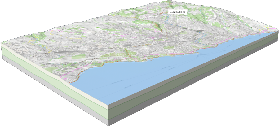
Explore Lausanne with a Stunning 3D Map
Discover the beauty of Lausanne with our interactive 3D map that highlights the city’s landmarks, lakeside scenery, and cultural hotspots. Experience the Swiss Riviera from a new perspective and explore detailed elevations, routes, and points of interest. Dive deeper into Lausanne’s highlights and see the city brought to life in 3D.